|
|
|
 |
|
|
|
|
|
|
        |
Maps can be used in a number of different ways with regard to our hobby. In the initial stages of site location we can try and identify locations where there may have been habitation: flat areas, good defensive positions, good drainage, perhaps on a boundary between Celtic tribes, a clean supply of water, perhaps a Roman road in close proximity, even somewhere with an impressive view could be the site for a dwelling. It may well be worth while to undertake some field walking expeditions to determine whether any potsherds or other remnants exist.
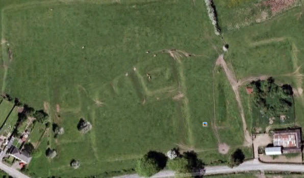
There is a wealth of information available via old maps, existing Ordnance Survey maps and via Google Earth (or similar). The following screen shot shows crop- or parch-marks indicating some form of construction under the pasture which may not be readily available at ground level. A good place to start looking!
|

|
||||
|
|